Posts Tagged ‘overhead view’
Drone Views
Despite some gusty winds on Sunday, there was an opportunity to view our property from overhead via a drone. I find this a spectacular variation of our perspective of the immediate surroundings we traverse every day. Much better than simply viewing a dramatically more distant 2-dimensional image from a satellite photo.
Let’s take a little tour, starting at the house…

That’s a lot different view from all the shots of the house we’ve tried taking from down below in the backyard.
Down the hill and through the short corridor of trees we come to the labyrinth.
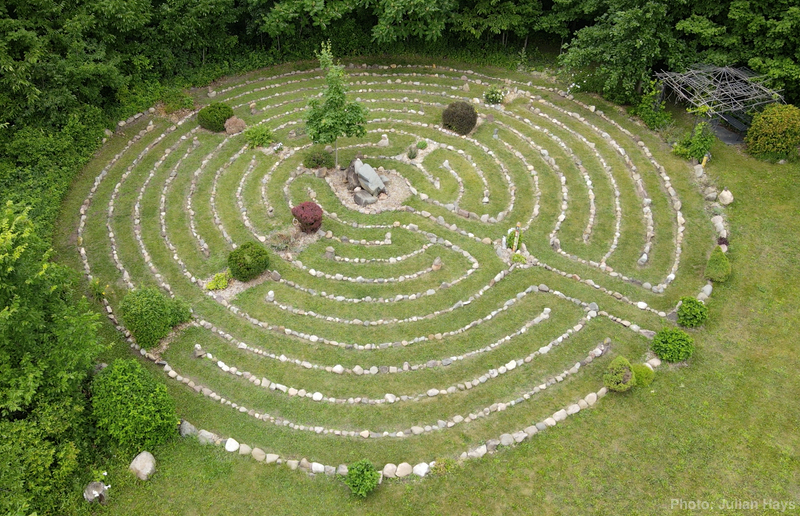
If you are careful to spot the 180° turns, you can walk the path with your eyes. Imagine the sounds of the breeze in the trees, the calls of songbirds, and maybe the sound of horses grazing in the back pasture.

I was pleased to see the drone didn’t startle the horses but Mix certainly took notice and circled the herd around once for good measure. Then they all went back to grazing.
Back up the hill of the backyard and past the house, we come to the shop and garage.
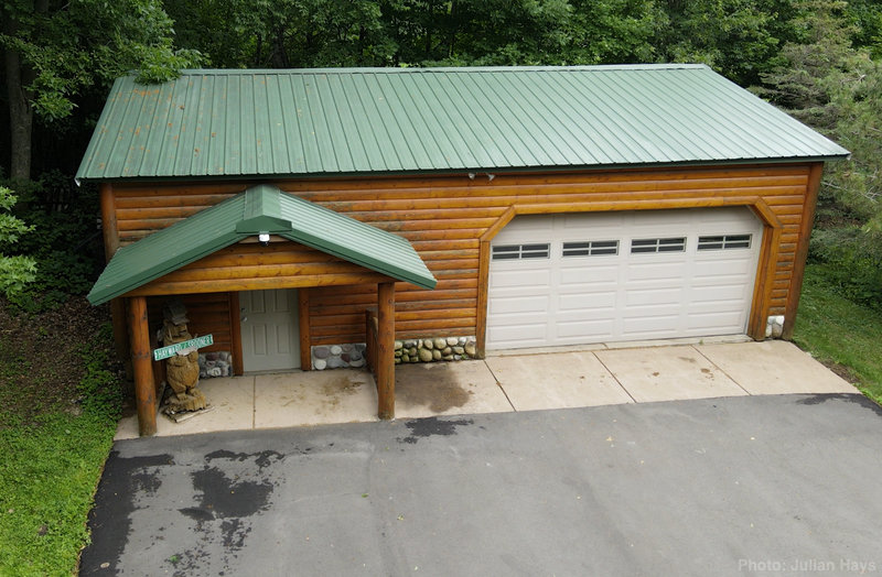
The amount of equipment squeezed inside is a mystery with the doors closed.
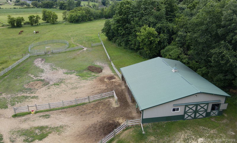
Finally, the drone was steered out for a brief glimpse of the barn before the dwindling battery brought the exercise to a safe conclusion.
The trees are so full of leaves that it made it difficult to capture a low-angle view that revealed the proximity of each feature in relation to the others.
We spent some time trying to fly down one of the paths in the woods but the drone was reluctant to follow commands smoothly due to the detection of nearby trees and low-hanging branches.
It was a thrill for me to watch the process and I treasure the views that we captured. Makes me want to have a jet pack that would let me quickly pop up for a similar view whenever the higher perspective seems warranted.
Maybe Greenworks will come up with a battery-powered one soon.
.
.
Finally Connected
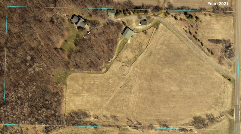
Ten years ago today, October 18 was the very day of our arrival to this property we call Wintervale. Hoorah! I looked up our property on the county site and grabbed a couple of images from the widest span of dates available.

 .
.
.
.
.
.
.
On the left is the year 2010 which was two years before we purchased the property. On the right is from 2021 according to the county.
I prefer the images our friend Mike Wilkus provided from his recent flyover.
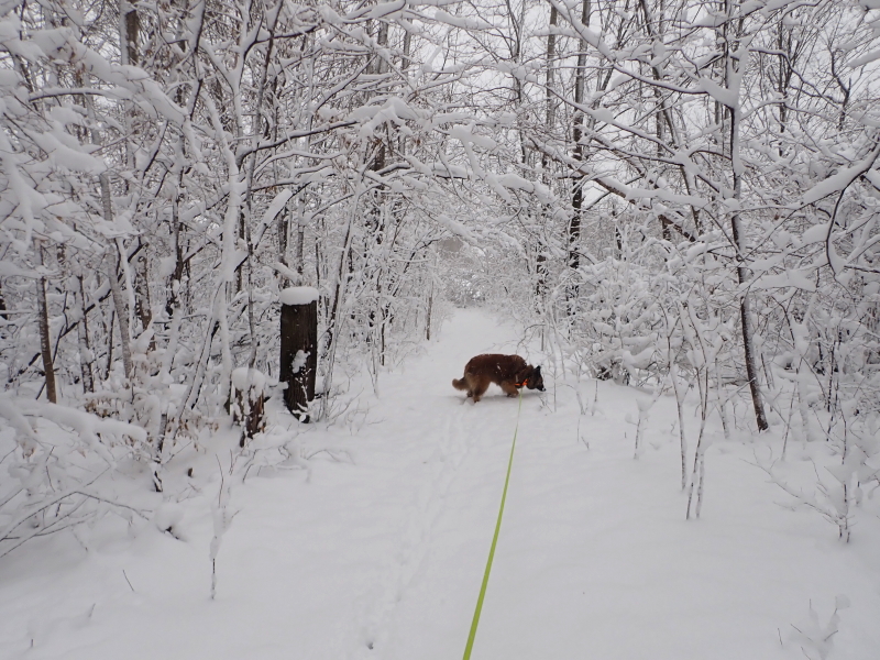
I was hiking the north loop trail with Delilah, waiting for the arrival of our in-home broadband internet installer to finally connect us to the world of streaming content, and spotted this scene of pine needles carpeting the ground.
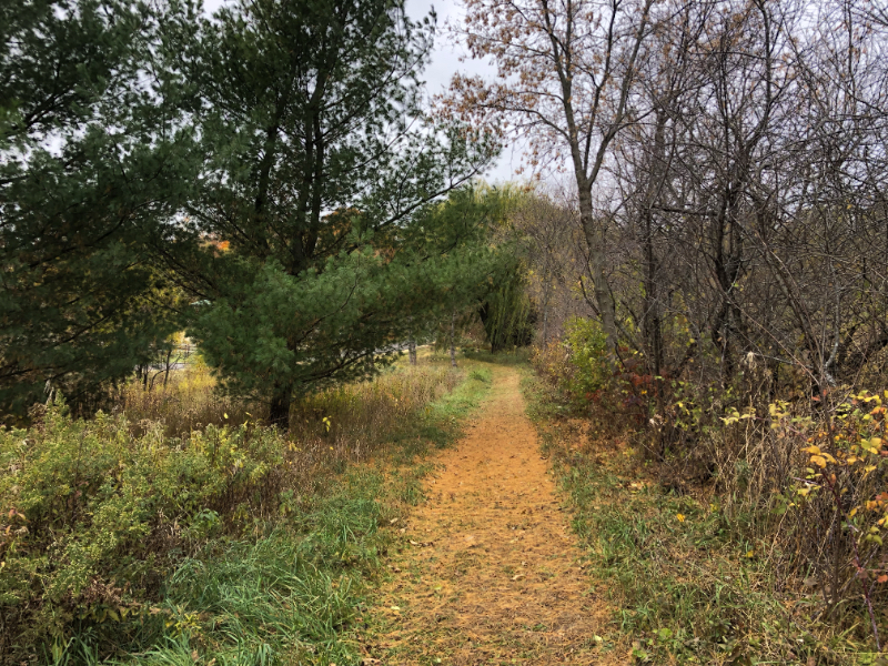
I’m sure glad that tree isn’t over our landscape pond.
As can be seen from the view perspective of Mike’s photo above, there are cultivated crop fields around us, keeping us aware that we live among farmers.
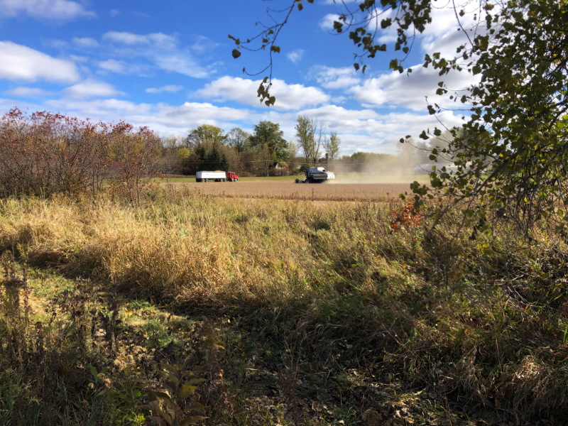
Yesterday the closest field to our south was being harvested. Something tells me we aren’t in the suburbs anymore.
That’s quite all right with me, …especially now that we are hardwired with fiber optic broadband.
.
.
Wing Wave
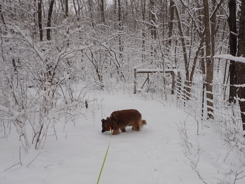
Well, the woods look a lot different now than they did on Saturday.
 .
.
.
.
.
.
.
.
.
It is mind-boggling how much things can change in one day. It is such a dramatic difference to go from walking our trails on a warm, sunny day to tromping through deep snow the next.
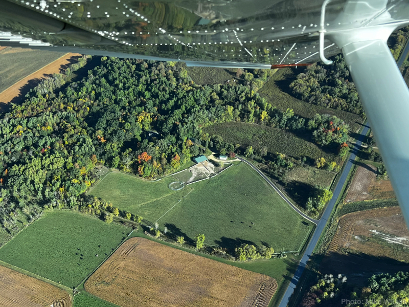
Yesterday, while describing my landscaping adventures, I forgot to mention the total highlight of the day Saturday. I was toiling away placing some bales along the property line when a small plane approached and made a banked turn. I pay attention when small planes show up because I know a number of pilots whom I always hope will visit when they’re in the area.
When the plane continued the loop and came around again, my confidence jumped that it could be one of my friends in high places. I was in a tangle of trees at that moment and chose to make a break for the most open space nearby, which turned out to be my neighbor’s field.
I looked up into the sun in hopes my sunglasses might reflect my presence and waved my arms. The plane rocked its wings in response.
It’s such a thrill to receive that acknowledgment. At the time, I still wasn’t clear who it was, but I was confident it was someone I knew.
Then my phone registered a message. It was from Mike Wilkus.
“There is a man outstanding in his field. Or at least the neighbor’s field.”
He sent me some wonderful photos.
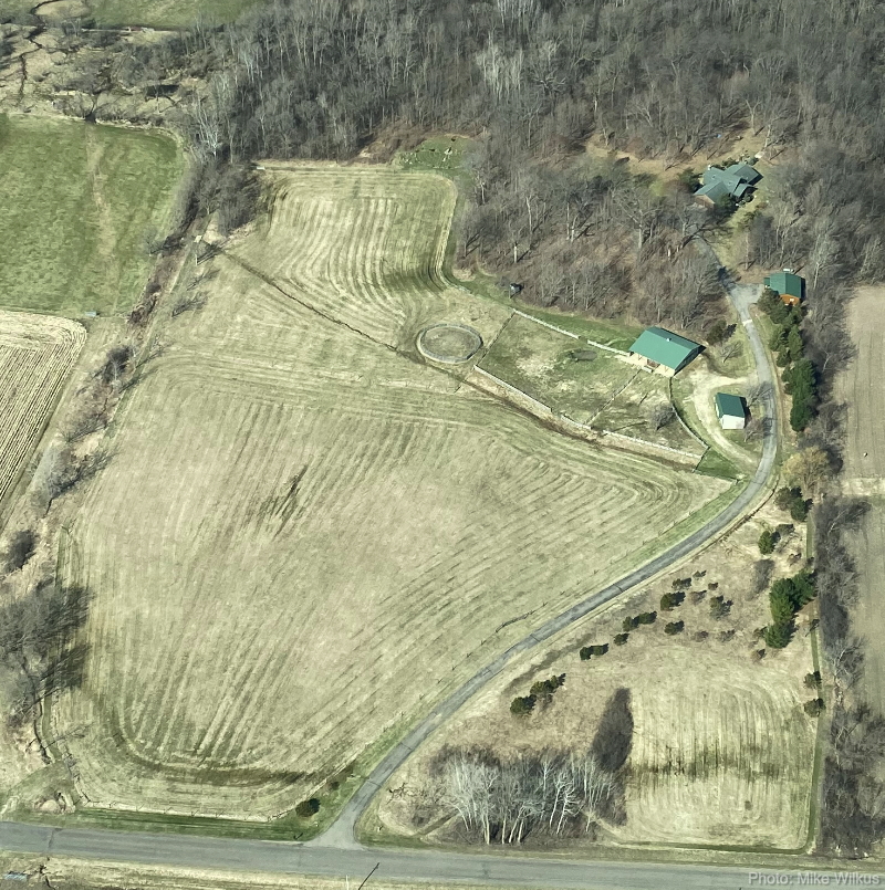
From the road at the bottom of the picture you see our driveway climb beside the big hay-field and turn at the hay-shed and barn, rise past the shop garage to the house at top. The paddocks and round pen are clearly visible, as is the labyrinth tucked in trees above the upper pasture that was also cut for hay last year.
And zooming in for a closer view, in the neighbor’s field there is a guy waving.

Thanks, Mike!
That view would sure look a lot different today with all this snow we received.
We had about 8 inches by the time I went to bed last night. I wonder how long it will take to turn it all into water that will keep us in the mud season for an additional week or two.
.
.
Updated View
The satellite view I reference most often was finally updated to show our property after all our renovations. Back in early July, I posted about my surprise finding that the satellite view available on Apple devices was updated to 2015. I recently discovered that the view on Google maps has been updated to show our property as of this spring, 2016.
We are able to see the wild flower garden that Cyndie had started and the T-post fence we put up to sub-divide the back pasture, both of which happened in April. The trees look fully leafed out and I had obviously mowed the lawn, but the farm fields look bare.
 I found particular pleasure in noticing that all 4 horses were again in view. This time they are somewhat evenly spread, grazing around the perimeter of the round pen.
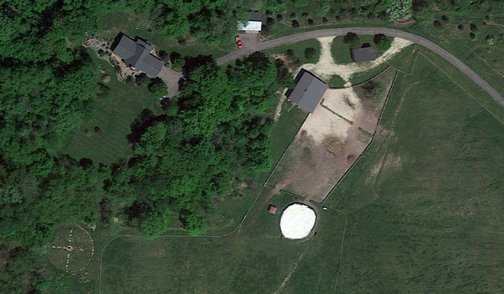 We found one object that we haven’t been able to identify in the yard. The resolution stops just short of providing the necessary definition. If it were a different color, I’d guess it might be me mowing the lawn.
I may need to review my posts from that timeframe to see if there is anything that triggers a memory about something we had been up to in that spot.
I love having this overhead view to refer to. If satellite images weren’t available on the internet, I just might be inspired to get a drone, so I could take my own shots and have some control over when and how often they are done.
I’ll be interested to see how long this view is active on Google. Now that I have a good reference point, the next update will clearly reveal the duration between updates of this region.
.
.
.
.
.
.
.
.
.
.
.


