Posts Tagged ‘maps’
Updated View
The satellite view I reference most often was finally updated to show our property after all our renovations. Back in early July, I posted about my surprise finding that the satellite view available on Apple devices was updated to 2015. I recently discovered that the view on Google maps has been updated to show our property as of this spring, 2016.
We are able to see the wild flower garden that Cyndie had started and the T-post fence we put up to sub-divide the back pasture, both of which happened in April. The trees look fully leafed out and I had obviously mowed the lawn, but the farm fields look bare.
 I found particular pleasure in noticing that all 4 horses were again in view. This time they are somewhat evenly spread, grazing around the perimeter of the round pen.
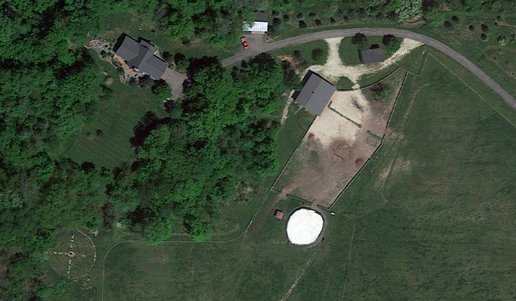 We found one object that we haven’t been able to identify in the yard. The resolution stops just short of providing the necessary definition. If it were a different color, I’d guess it might be me mowing the lawn.
I may need to review my posts from that timeframe to see if there is anything that triggers a memory about something we had been up to in that spot.
I love having this overhead view to refer to. If satellite images weren’t available on the internet, I just might be inspired to get a drone, so I could take my own shots and have some control over when and how often they are done.
I’ll be interested to see how long this view is active on Google. Now that I have a good reference point, the next update will clearly reveal the duration between updates of this region.
.
.
.
.
.
.
.
.
.
.
.
Past Views
On Sunday, we are hosting a neighborhood gathering for a cookie social. I was thinking ahead about a way I might match the people we hope will come, with the locations of their homes. I looked at property records online for an overhead view with the house numbers shown. I was considering the possibility of printing it out and having people sign in and mark their location on the map.
Unfortunately, that view, sized for a normal printer, ended up being too small to be much good. I may simply resort to having my computer there with the view that can be zoomed in and out. People could point at their homes on the screen.
While I was looking at the county map, I realized that it is a little different than the Google Earth view with which I am more familiar. I’m pretty sure the county image is older. It occurred to me that I should capture and save both for a historical reference.
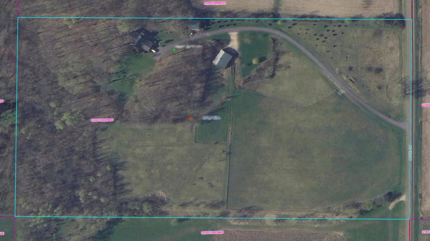 Above is the view from the county property records site. Below is the view from Google Earth. It hasn’t changed since we started looking at it in 2012.
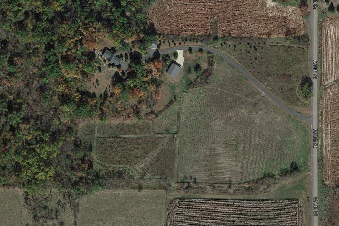 I did a search to see if I could learn how often the Google view gets updated. They claim to do so about every 3 years. We are due. I don’t know if that means they will soon post a current view, or that soon they will update it with a view from some time in the recent past.
It won’t be too hard for me to identify if a new view is from a time after we took possession, since we made a wide variety of frequent changes over the last 3 years. I’m particularly interested to see what the labyrinth looks like from space.
I’m also hoping it will be from a time when the horses were out in one of the fields. It would be really nice if that worked out.
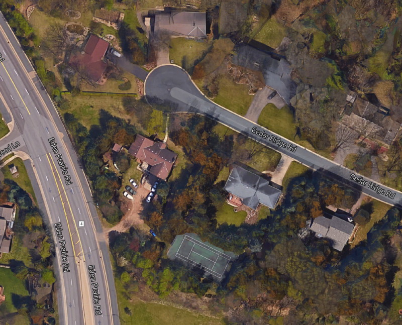 As long as I was at it, I ventured over to a view of the old neighborhood in Eden Prairie where my family lived when I was a tween/teenager. I’ll post it here for my brothers and sisters to see. It is recognizable, despite a few changes. The road at the end of our driveway was a 2-lane back in the day, and crossing it led to a farm field, not another neighborhood.
I wonder if there are any photos of this view from back in the 1970s, maybe taken from one of the small planes out of Flying Cloud Airport.
That’s a past view I would particularly appreciate seeing.
.
.
.
.
.
.
.
.
.
.
.


